
Here are some photos from my recent backpacking trip through 44 miles of Buckskin Gulch and Paria Canyon in Utah (where we entered) and Arizona (where we exited). I was accompanied by my girlfriend Kate and our friend Jon, who are pictured above. They made considerable fun of me for lagging behind all the time, but how else was I supposed to get shots like this?
Day 1: Buckskin Gulch via Wire Pass to the Confluence (13 miles)

The night before the trip began, we parked at Lee's Ferry, where we would exit the canyon 5 days later, and took a 2 and 1/2 hour shuttle ride to the Wire Pass trailhead, where we would begin the next morning. It was well past dark by the time we got to our first night's camp. We woke up the next morning, by alarm, to this sunrise. Not a bad way to start a trip.

Wire Pass is a shortcut into Buckskin Gulch that shaves a couple miles off the first day's trip. This is what it looked like as the trail began. That's Kate and Jon up ahead of me - we would hardly see any other people, and only in brief passing when we did, for the duration of this trip.

Within its first couple miles, Wire Pass slots up. The canyon walls are red, intricately sculpted Navajo Sandstone.

This was just the beginning of a 13 mile first day through the longest slot canyon in the whole wide world. I'd seen pictures and spent months planning this trip, but nothing could have prepared me for the actual experience of being inside this thing.

Several spots within Buckskin Gulch are filled with opaque brown water, snowmelt that gets left behind after flash floods and never evaporates because the sun simply doesn't penetrate far enough into the canyon. The water was freezing cold. Though it was easily 80 degrees in the sun, within the canyon I doubt the temperature was more than 65.

The water was deep in spots.

Buckskin does widen at several points. When the sun from these areas hits the curving redrock walls of the slots as you approach them, the walls glow like the coals of a campfire.

© 2007 Jon Leland
.jpg)
© 2007 Jon Leland

© 2007 Jon Leland

We'd emerge into openings like this one periodically, where riparian vegetation would bloom in greens that were all the more vibrant against the red canyon walls.

Kind of like being born, isn't it?


How cool are these walls? Despite the 40 pounds on my back, I was pretty much gawking and stopping and staring through the entire 13 miles.

At the end of a long first day, we camped just past the confluence of Buckskin Gulch and Paria Canyon. Despite our proximity to the trailheads, we saw only a couple other people, and none once dusk began to fall. The only sound was that of the river rippling over pebbles and around bends in the far wall of the canyon.

Yes, this was Paradise.
Day 2: Confluence to Judd Hollow Springs (11 miles)

It is important to make #2 well away from the high water mark. Though we bury our business neatly and dispassionately, like Michael Corleone, flash floods regularly wash out everything in their reach. So we'd climb to a high point when duty called. The only other ecologically responsible option was to deposit our goodies into a mylar "WAG bag" and carry this around with us for a week. Kate tested this proposition first and we decided not to repeat it. Her supposedly odor-proof WAG bag was tied up inside a pair of supposedly odor-proof Glad trash bags, and stored for the remainder of the trip inside a compartment of her backpack the existence of which she refused to acknowledge until days later.

From high places, the perspective on the river and the canyon changed. Kate and John had climbed to the rim at the Middle Route in Buckskin Gulch, but this was my first look down at the river from above.

Pretty cool.

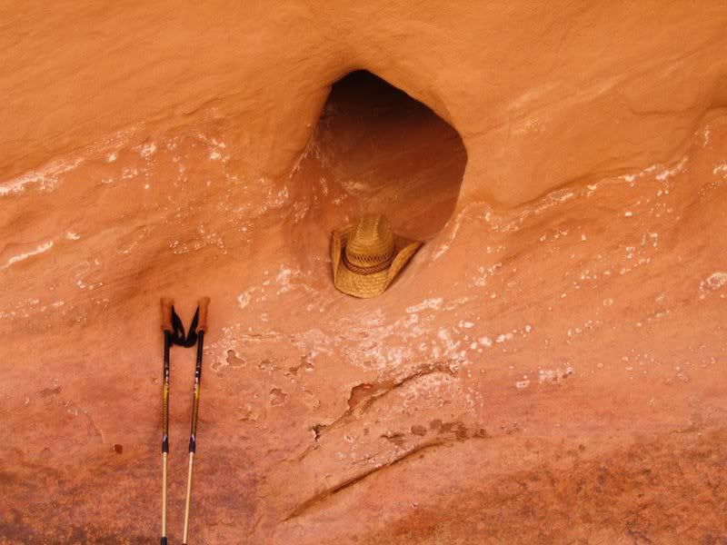
The sights this day were beautiful in a different way. The walls around us were still all Navajo Sandstone (this would change), but the canyon was beginning to widen (which would continue). The river had carved all kinds of amazing cathedrals and alcoves (see the picture at the top of the post), and pillars, posts and potholes like these.

Later in the day, we came across remains of the Adams Water Pump, representing the last attempt (made in the 1940s) to extract water from the lower Paria.

We hiked another mile or so past the pump to our second night's campsite. There are many springs through this section of canyon, which helped feed thicker vegetation than we had yet seen. Large cottonwood and box elder trees stood out, but a variety of reeds, rushes and grasses lined the riverbed and canyon walls as well. Where the springs were, hanging mosses and ferns grew right off the walls.


Camp that night was under a huge, beautiful cottonwood tree across from a large natural spring where we were able to wash a bit and fill up with fresh water. The water of the Paria is potable if filtered or purified, but very silty.

We had gotten to the water pump well before we thought we would. We realized that we'd come 24 miles, more than half our distance, in just the first two days. We relaxed under our cottonwood and looked forward to the easier days ahead of us. We'd do significantly fewer miles and have time to drop our packs and explore side canyons and scrambles toward the canyon rim.

Day 3: Judd Hollow Springs to Shower Spring (4 miles)
There was very little mileage to do this day, which we were happy about. We planned to drop our packs and explore Wrather Canyon, a major side canyon that features one of the world's largest and most unusual natural arches (at least, that's what our guidebook said). The main canyon continued much like the day before.

Wrather Canyon is narrow with a pretty good flow of water and lots of sun, which equals lots of vegetation! As we hiked through its lower reaches, we were bushwacking through living and fallen trees. It was a real contrast to even the greenest parts of the main canyon, and felt like the woods - until you'd look at the fine, packed, red sand underfoot and the red walls looming beyond the dense tree branches.


After a mile and a half or so, we approached the arch, which loomed at the top of the hill. The arch is notable because it is supported by only one leg; it's other side runs into the canyon wall.

It was a pretty steep hike up to the arch, which was truly enormous.

A steep hike through it and back down to the other side, too.


Testing my camera's self-timer feature just beneath Wrather Arch. Most of our time through the canyon, the three of us hiked at our own paces. Because I was stopping so often for pictures, and because I am generally slow, I was usually on my own behind Kate and Jon.
The second half of this day, though a very short 2 miles, was tough. I had developed a couple of painful blisters, and the buckle of my special fancy canyon shoes was digging into the spot where my leg and foot meet, on top of the foot. I trudged on to our campsite at Shower Spring, a gorgeous, large spring and pool hidden behind some willows, thankful that the day would be short and a bit worried about how my blisters would stand up to the 16 miles we had ahead of us.
Day 4: Shower Spring to High Water Route (6 miles)

I was lucky: a night's rest had apparently taken care of my blisters. We started the day a bit late, and I felt re-energized. I scrambled to a high mesa on the canyon wall above our campsite and took this picture. Shower Spring is hidden behind the vegetation on the far bank of the river. Another interesting feature of the canyon had recently emerged as well: we had now lost enough elevation that the river was cutting through a new layer of rock, known as the Kayenta Formation. It is comprised of the layers of red slate rock visible above the far bank (and to the right) in this shot, quite distinct from the smooth Navajo Sandstone wall above it. In geologic history, we had left the Jurassic period and entered the Triassic. This rock was roughly 195 million years old (the Navajo Sandstone dates to about 135 million years). I never gave a crap about geology, but walking through a canyon and seeing the naked rock change before your eyes definitely makes it seem more interesting. At least to a nerd like me.

After only another mile or so, another layer of rock became exposed. The pinkish bed of the river seen here is part of the still older Moenave Formation.

It can be seen here that the Moenave is only exposed a few feet high. The blocky Kayenta sits on top of it.

We stopped for lunch at our last reliable spring, which meant we'd have to fill up all our water bottles (6L+ each) for the rest of the trip. Above this spring was one of the coolest things we'd see on the trip - rock art, petroglyphs carved by Anaszi people 900 or more years earlier. Lots of people and bighorn sheep, as well as other spirals and who knows what.


We relaxed here, eating and filling our bottles. We could probably have filled directly from the springs, but we were concerned about all the livestock in the area, so we decided to let the springs fill a collapsible bucket we had brought and then filtered the water from that. We set out from lunch, aiming to do another 5 miles, which would leave us 8 on our final day.
Parental Advisory: The following portion of this post may not be appropriate for younger viewers.
Press Play for accompanying sound:

Froggy style!
A few boulders resting in a bed of quicksand had formed a pools of water that, apparently, was the frog equivalent of the Roman baths in Caligula. As it turns out, though, a science teacher friend informed me that these frogs are not actually doing the nasty. The male frog squeezes the eggs out of the female frog, after which he sprays some sperm on the eggs to fertilize them. And thus begins the miracle of froggy life. Sure, whatever. I suppose. But I like to think that these frogs know what's up. That's my frawgg right there, B!

Awwwww....yeahhhhh.
This concludes the titillating portion of our program. The remainder of this post shall be appropriate for all viewers.

The canyon really began to widen out at this point. The walls were also climbing higher as we walked deeper into the canyon. They rose over 1,000 feet above us now (they were only 100-200 feet high in Buckskin Gulch).

You can just make out a lighter colored rock on the the top edges of the walls in this picture; this is composed of a couple layers that sit above the Navajo Sandstone and are more prevalent in the walls of the Grand Canyon, which lay a short distance to our south.


One of the things that amazed us continually was the way the character of the canyon changed as we walked through it. The ever-widening vistas of these lower reaches bore little resemblance to the narrows we had come through earlier, or even the sandstone-dominated sections of the second day.

More open sky meant more sun, which meant wildflowers. We finally started seeing some in bloom during the afternoon of the fourth day, though we seemed to be a bit early for a real show of the kind we had in Death Valley last year.

The river at this point began to be increasingly choked with boulders. A high route had been defined by earlier hikers and we began to follow it instead of the river. The trail would rise and fall along the low edges of the climbing canyon wall; a lower portion is visible here.

Towards the end of the day, only a mile or so from camp, I decided to drop my pack and scramble up a steep talus slope towards what looked like a low rim in the wall. When I reached the top, I saw just a short, boulder-strewn plateau with another steep climb to reach the vertical section of wall above me. Here, the boulders were enormous and I had fun negotiating the thickest section of giant boulders as I climbed towards the wall. I scanned the ground continuously for rattlesnakes, but didn't see any. Some of the rocks were loose, including some fairly large ones, so I moved cautiously. I admire Aron Ralston but was not interested in cutting off my own arm.

The view from this height was incredible. This is the highest point I could climb to; at this point the Kayenta rock was at my back and vertical for at least a few hundred more feet. There had been spots during the previous day where it was possible to climb all the way to the rim, and I now regretted not having tried those. Kate and Jon had scrambled up pretty far yesterday afternoon, aiming for a shot at the rim described in our guidebook that would let them look down on Wrather Arch from above. My feet had been in bad shape at the time, so I went ahead to camp. They weren't able to find the route, as it turned out, and never got that view. In any event, it was not hard to console myself with "only" attaining the views I did from this spot shy of the canyon's rim.

Another timer shot of me in my rugged man pose. You can see the river far beneath me (it's about level with my knees in the shot). The different rock formations are clearly visible in the opposite wall behind me.

A short while later, I joined my friends in camp. The dramatic clouds above us made for a beautiful final night in the canyon, and somehow they cleared out in time for the stars. I didn't bother trying to take any pictures of the night sky without a tripod - probably I should have - but it was amazing. Not exactly a lot of light pollution in this part of the world.
Day 5: High Water Route to Lee's Ferry (10 miles)

We realized at some point that we had not hiked as far as we'd thought the day before. We would have 10 miles to go today rather than 8. These last miles would be across open desert as the canyon was now quite wide. We had some purpose to our hiking this final day: there was an all-you-can-eat barbeque happening between Page and Kanab, as much as two hours from our car, and we were not about to miss it. We would try to make it to the car by 2 pm. As such, we got a very early start (6 am or so); the early morning sun illuminated the western cliffs as we set out, heading south towards our car at Lee's Ferry.

Toadstools in the hillside.

The canyon walls began to resemble more and more those of the Grand Canyon.

We saw more petroglyphs. Some asshole added his own commentary to this boulder. Don't deface archaelogical sites, kids. It's bad karma. Somewhere, Mr. Click is spending eternity being gruesomely disembowled by the angry ghosts of Anasazi artists.

Another toadstool stood nearby. I loved these things.

We had thought, at breakfast, that we would be able to avoid river crossings today. We were wrong. Wet socks and 25 pounds on my back were more than my abused feet could take, and by lunch, my blisters had returned with a vengeance. I would discover back in the car that each of my little toes sported its own blister the size of each of my little toes. My right foot also had blisters on its ball and heel. I hobbled through the last 6 miles of desert like an old man looking for the shuffleboard court. The pain was searing, but the scenery was lovely. I reached a place of zen. Each step was its own new torture, yet I had never been in a place like this and would not again any time soon. I leaned hard on my trekking poles and just kept moving.


© 2007 Jon Leland

The sky was brilliant and the clouds light and luminescent. I wanted to take so many more photos, but I had maxed out my memory card. And so there are no pictures of the three of us at the car, triumphant and dreaming of barbeque. No pictures of my blisters, which repulsed Kate and Jon. No pictures of the nice Native American people selling turquoise jewelry from the roadside. No pictures of the Best Western in Kanab, where we showered and changed before dinner, and none of the roadside BBQ and horseback riding joint where we gorged ourselves with chicken, beef ribs, brisket, cinnamon buns, beans, salad, and deserts. No pictures of the 18 naked Swedish girls we helped with their flat tire. No pictures of the bobcat I trained leaping through the ring of fire created as I spun a flaming truck tire from my Prince Albert. No pictures of the 53-member monkey choir singing Mel Torme songs from the top of an unscalable mesa. No pictures even of the crazy stuff we saw on our two dayhikes we took before beginning the canyon trip, because I inadvertently deleted them all during our first night in camp. Not that there would have been room for them anyway. The rest of the vacation passed without photographic evidence, making it possible that it did not happen at all.
This Post Has Been Brought To You By Consolidated Power and Pollution

We may not be real pretty but we 'lectrify your city! Uh huh! Haw haw! Let me hear you! Utah!
1 comment:
This is great info to know.
Post a Comment